Tuesday 31 January 2012

TUESDAY JANUARY 31st

A WARM WELCOME TO PITLOCHRY WEATHER!

THE ONLY ONLINE WEATHER SERVICE WHERE THE OBSERVER LIVES & RECORDS IN PITLOCHRY, USING PREVIOUS MET OFFICE CLIMATE STATION EXPERIENCE. FORECASTING IS BASED ON MET OFFICE & BBC MATERIAL, WHICH IS THEN TAILORED FOR THE PITLOCHRY AREA, USING LOCAL KNOWLEDGE & EXPERIENCE. http://www.pitlochryweather.blogspot.com/

TODAY'S FORECAST FOR PITLOCHRY
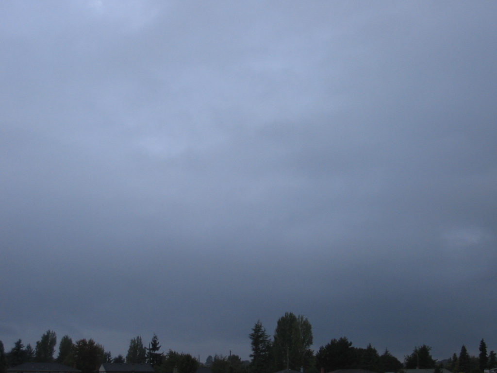
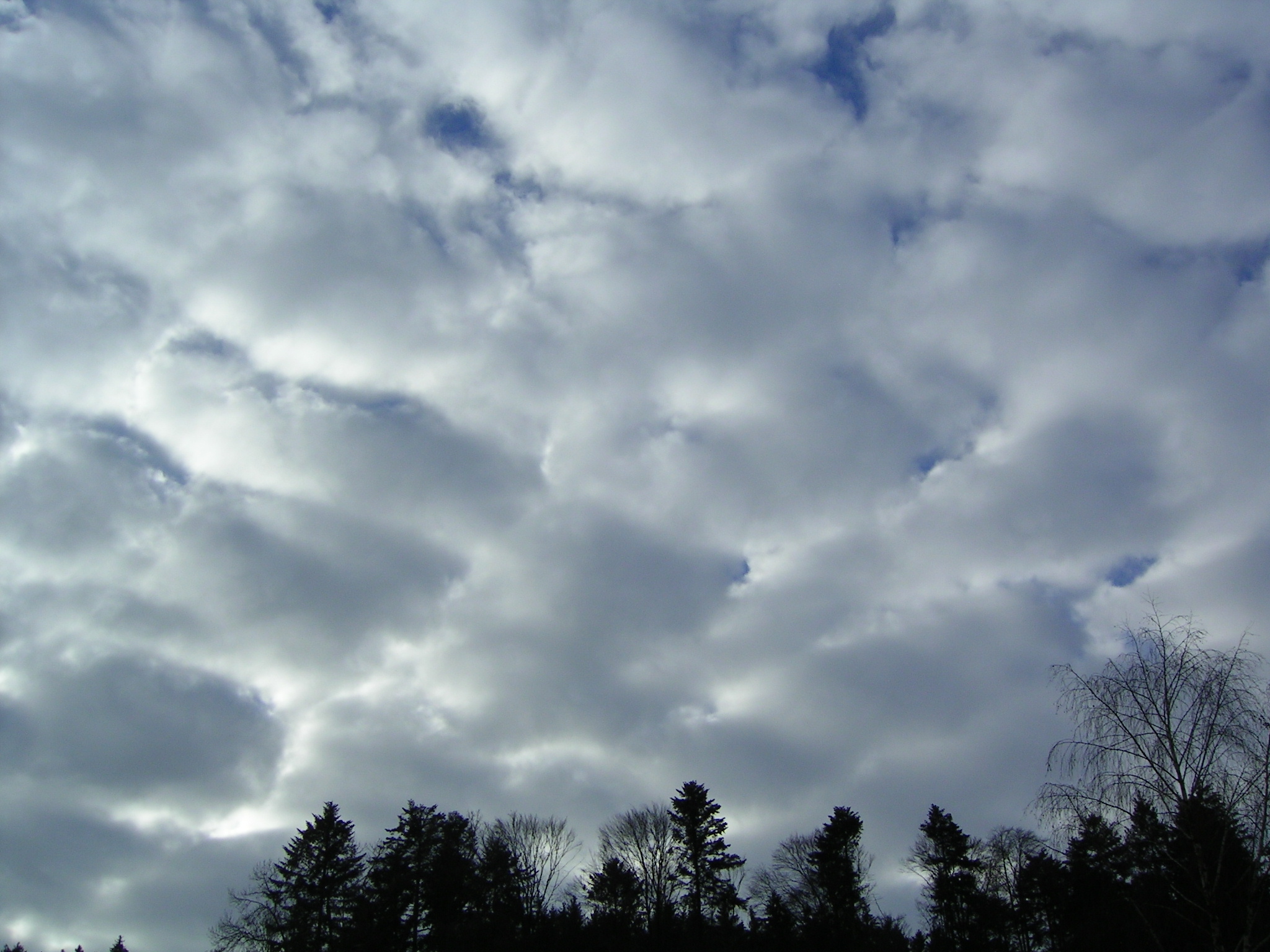
A cloudy start, though temperatures at +2.1. With time, there may be some breaking of the cloud sheet, allowing some brightness & a few sunny intervals. Winds will be E. or SE force 2 to 4 & highest temperatures will reach 3 or 4 degrees.   TONIGHT--some cloud breaks should persist, allowing temperatures to fall to around -2, perhaps lower in any longer cloud clearances.
Temperature at obs. time today 08302.1
Maximum temperature (last 24hrs)2.6
Minimum temperature (last 24hrs)-0.3
Grass minimum temperature (last 24hrs)-3.4
Rainfall total (last 24hrs)0.1mm
Barometer at observation time today1030mbs
Wind at observation time todayE3
This month’s highest temperature to date11.0
This month’s lowest temperature to date-8.1
This month’s highest 24hr rainfall total to date31.9mms
THIS MONTH'S TOTAL RAINFALL TO DATE100.1mms

AVERAGES & EXTREMES JANUARY
Avg. max. temperature5.3Long term avg. rainfall109
Avg min. temperature-0.9Wettest month273
Record high temperature13.7Driest month10.6
Record low temperature-19.6mms

For longer outlook periods,surface pressure charts, mountain weather & severe weather warnings, go to the Met Office's regional forecasts and click the relevant headings.

YESTERDAY IN PITLOCHRY
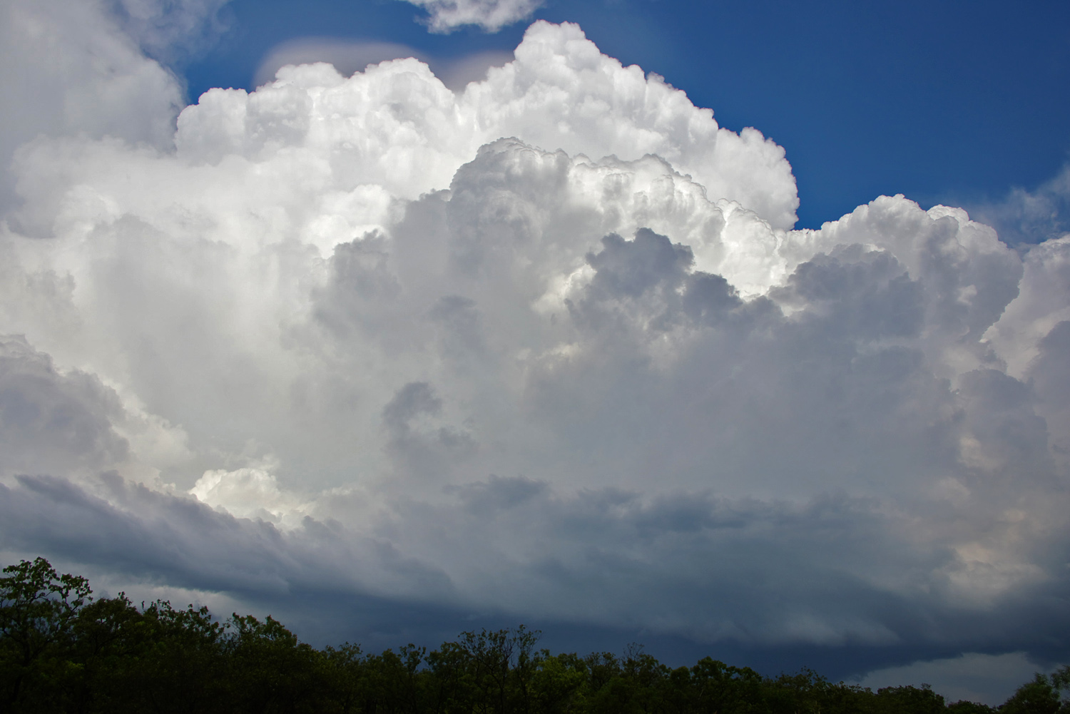
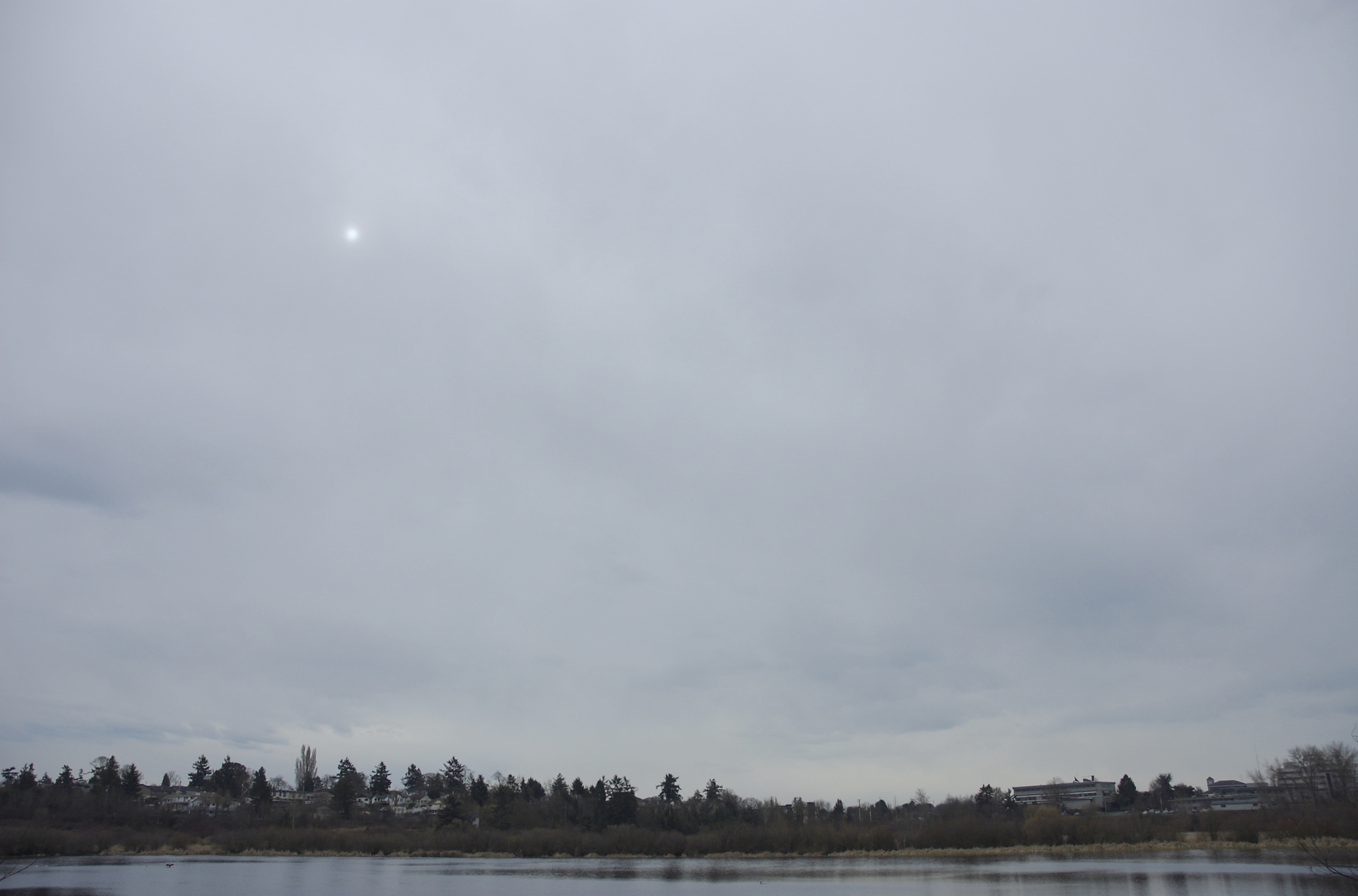
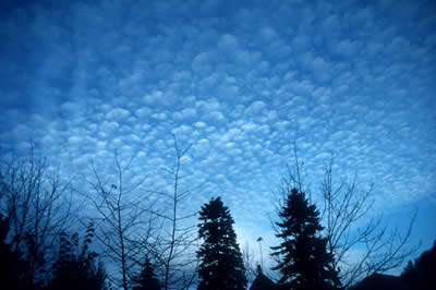
A couple of lessons to learn from yesterday!  1. High pressure is no guarantee of blue skies & sunshine. Pitlochry can often be troubled with winds blowing off the North Sea bringing sea fog or a layer of stratocumulus cloud,even with a little rain, with barometers reading sky-high.   2.(More positive)--Even in a very cold airstream, a decent layer of cloud cover can provide a very effective blanket for keeping frost at bay--as almost happened last night. Evidence of slight snow grains on the lawn.

THE GENERAL WEATHER PATTERN AROUND THE BRITISH ISLES
A huge high pressure system remains over N.Russia keeping Atlantic fronts at bay.

TOMORROW'S FORECAST FOR PITLOCHRY
A mixture of a little brightness & broken cloud & more cloudy spells. Remaining cold with best temperatures around 3. Winds force 2 or 3 from the E. or N.E. Frost if any clear spells.

Monday 30 January 2012

MONDAY 30th JANUARY

A WARM WELCOME TO PITLOCHRY WEATHER!
THE ONLY ONLINE WEATHER SERVICE WHERE THE OBSERVER LIVES & RECORDS IN PITLOCHRY, USING PREVIOUS MET OFFICE CLIMATE STATION EXPERIENCE. FORECASTING IS BASED ON MET OFFICE & BBC MATERIAL, WHICH IS THEN TAILORED FOR THE PITLOCHRY AREA, USING LOCAL KNOWLEDGE & EXPERIENCE. http://www.pitlochryweather.blogspot.com/  (put this address in your favourites to secure a direct link! )

TODAY'S FORECAST FOR PITLOCHRY
There may be some brightness around today, but also some areas of cloud, coming off the North Sea.Some parts of the Eastern Grampians will have some spells of mainly light snow, but much of the time should be dry locally, with just a small chance of the odd patch of rain or sleet. It will feel cold & raw, with SE winds blowing up to about force 3 or 4. Maximum temperatures will only manage 3 degrees at best. There may be a frost tonight, as long as there are sufficient cloud breaks.
Temperature at obs. time today 08151.6
Maximum temperature (last 24hrs)3.5
Minimum temperature (last 24hrs)0.3
Grass minimum temperature (last 24hrs)-0.1
Rainfall total (last 24hrs)1.0mms
Barometer at observation time today1029mbs
Wind at observation time todaySE2
This month’s highest temperature to date11.0
This month’s lowest temperature to date-8.1
This month’s highest 24hr rainfall total to date31.9
THIS MONTH'S TOTAL RAINFALL TO DATE100.0mms

AVERAGES & EXTREMES JANUARY
Avg. max. temperature5.3Long term avg. rainfall109
Avg min. temperature-0.9Wettest month273
Record high temperature13.7Driest month10.6
Record low temperature-19.6mms

For longer outlook periods,surface pressure charts, mountain weather & severe weather warnings, go to the Met Office's regional forecasts and click the relevant headings.

YESTERDAY IN PITLOCHRY
Cloudy for much of the time, as an air flow off the North Sea began to import moister, cloudy conditions. The positive side of this was that we avoided a frost last night. Light rain & drizzle here last evening & overnight, fell as snow over eastern parts of the Grampians

THE GENERAL WEATHER PATTERN AROUND THE BRITISH ISLES
A huge high of 1062mbs is situated over Northern Russia. Pressure is low over the Atlantic & Central Mediterranean. Fronts are queueing up in the Western Approaches, but are unable to advance further east.
TOMORROW'S FORECAST FOR PITLOCHRY
Rather a lot of cloud around, coming off the North Sea. Perhaps a slight frost at first  Just a chance of a few brighter spells. There is also a chance of a few light snow flurries, more especially on the hills to the east of Pitlochry, but no significant accumulations are expected. Winds mostly E force 2 to 4  & maximum temperature around 2 degrees. Overnight frost.

Sunday 29 January 2012

SUNDAY 29th JANUARY

A WARM WELCOME TO PITLOCHRY WEATHER

THE ONLY ONLINE WEATHER SERVICE WHERE THE OBSERVER LIVES & RECORDS IN PITLOCHRY, USING PREVIOUS MET OFFICE CLIMATE STATION EXPERIENCE. FORECASTING IS BASED ON MET OFFICE & BBC MATERIAL, WHICH IS THEN TAILORED FOR THE PITLOCHRY AREA, USING LOCAL KNOWLEDGE & EXPERIENCE. http://www.pitlochryweather.blogspot.com/   (why not put this in your favourites, as this address is a direct link to the site)

TODAY'S FORECAST FOR PITLOCHRY  RAIN IS FALLING ON FROZEN GROUND---ICY PATCHES ABOUT.
Pitlochry is currently being affected by a cloudy area giving some light rain. This should clear as the morning goes on to give dry & brighter conditions.  Perhaps later in the day, a few showers of rain or sleet may spread in from the North Sea, falling as snow above about 300m. It will feel cold with E. winds up to about force 3 & max. temperatures only reaching 3 degrees.    TONIGHT--Dry for much of the time with some clear spells & a frost.
Temperature at obs. time today 09000.4
Maximum temperature (last 24hrs)1.5
Minimum temperature (last 24hrs)-3.4
Grass minimum temperature (last 24hrs)-7.3
Rainfall total (last 24hrs)0.2mms
Barometer at observation time today1031mbs
Wind at observation time todaySE1
This month’s highest temperature to date11.0
This month’s lowest temperature to date-8.1
This month’s highest 24hr rainfall total to date31.9mms
THIS MONTH'S TOTAL RAINFALL TO DATE99.0mms

AVERAGES & EXTREMES JANUARY
Avg. max. temperature5.3Long term avg. rainfall109
Avg min. temperature-0.9Wettest month273
Record high temperature13.7Driest month10.6
Record low temperature-19.6mms

For longer outlook periods,surface pressure charts, mountain weather & severe weather warnings, go to the Met Office's regional forecasts and click the relevant headings. (A wealth of information is available by clicking on links)

YESTERDAY IN PITLOCHRY
Bright or sunny spells, with high & medium- level cloud patches. A cold day, however, max. only 1.5.

THE GENERAL WEATHER PATTERN AROUND THE BRITISH ISLES
Pressure is high over the continent & low over the Atlantic, leaving Britain in the battle zone between cold & mild air.
TOMORROW'S FORECAST FOR PITLOCHRY
Mainly dry & bright with E. winds force 2 or 3. Feeling cold, with highest temperatures around 3 degrees.

Saturday 28 January 2012

(LAST IN THE SERIES) CUMULONIMBUS--The cloud associated with thunderstorms.The base of this type of cloud is usually in the rage 1,500 to 6,000ft, but its brilliant white tops made of ice crystals, can be over 30,000 ft high.They are cauliflower-like large towers often with anvil-shaped tops.The base of the cloud is usually very dark & threatening.Squally winds are common beneath these clouds, which are usually given a wide berth by aircraft.Thunder & lightning are commonly associated features


SATURDAY 28th JANUARY

A WARM WELCOME TO PITLOCHRY WEATHER!
THE ONLY ONLINE WEATHER SERVICE WHERE THE OBSERVER LIVES & RECORDS IN PITLOCHRY, USING PREVIOUS MET OFFICE CLIMATE STATION EXPERIENCE. FORECASTING IS BASED ON MET OFFICE & BBC MATERIAL, WHICH IS THEN TAILORED FOR THE PITLOCHRY AREA, USING LOCAL KNOWLEDGE & EXPERIENCE. http://www.pitlochryweather.blogspot.com/

TODAY'S FORECAST FOR PITLOCHRY
The thermometer only -2.7 at 0900Hrs, so slippery surfaces likely. It should be a dry day, bright at times with some intervals of sunshine. However, there will often be some cloud around at high & medium heights, making for weak or watery sunshine. Winds will be mostly W. or SW. force 1 or 2 only. Maximum temperatures will struggle to only 1 or 2 degrees.
TONIGHT will see clear spells, patchy high cloud, light winds & a frost, with lowest values around -1 to -3 degrees.

Temperature at obs. time today 0900-2.7
Maximum temperature (last 24hrs)4.2
Minimum temperature (last 24hrs)-3.8
Grass minimum temperature (last 24hrs)-7.4
Rainfall total (last 24hrs)nil
Barometer at observation time today1030mbs
Wind at observation time todayW1
This month’s highest temperature to date11.0
This month’s lowest temperature to date-8.1
This month’s highest 24hr rainfall total to date31.9mms
THIS MONTH'S TOTAL RAINFALL TO DATE98.8mms

AVERAGES & EXTREMES JANUARY
Avg. max. temperature5.3Long term avg. rainfall109
Avg min. temperature-0.9Wettest month273
Record high temperature13.7Driest month10.6
Record low temperature-19.6mms

For longer outlook periods,surface pressure charts, mountain weather & severe weather warnings, go to the Met Office's regional forecasts and click the relevant headings.

YESTERDAY IN PITLOCHRY
Apart from some morning mist patches, it was a day with generous amounts of sunshine & light winds.

THE GENERAL WEATHER PATTERN AROUND THE BRITISH ISLES
Pressure is high to the south & east of Britain & low over the Atlantic. Barometers have risen considerably over the last 48hrs. Fronts are struggling to advance into western districts from the Atlantic & a "battle ground" between cold air & mild air is set to be played out across the country.

TOMORROW'S FORECAST FOR PITLOCHRY
The morning will start with a frost, but it should be bright, with patchy high cloud & sunny spells. Cloud may increase somewhat later in the afternoon. Winds will become mainly E. to NE force 2 to 3, with maximum temperatures up to about 3 degrees.

Friday 27 January 2012

NIMBOSTRATUS--The base of this cloud type can be between the surface & 10,000ft.In appearance, it is thick, grey & often dark.It normally gives continuous rain, sleet or snow, the sun or moon being totally hidden.

FRIDAY 27th JANUARY

A WARM WELCOME TO PITLOCHRY WEATHER!
THE ONLY ONLINE WEATHER SERVICE WHERE THE OBSERVER LIVES & RECORDS IN PITLOCHRY, USING PREVIOUS MET OFFICE CLIMATE STATION EXPERIENCE. FORECASTING IS BASED ON MET OFFICE & BBC MATERIAL, WHICH IS THEN TAILORED FOR THE PITLOCHRY AREA, USING LOCAL KNOWLEDGE & EXPERIENCE. http://www.pitlochryweather.blogspot.com/

TODAY'S FORECAST FOR PITLOCHRY
A slight frost initially & temperatures today unlikely to exceed 4 degrees. Rather cloudy at first this morning, with a small risk of a slight snow shower. Later on, cloud amounts should decrease, with some sunny spells Light winds less than force 3.
TONIGHT--Clear spells, light winds & a frost. Minimum temperatures close to -5 or -6. Perhaps some valley mist.  NOTE--although pressure patterns suggest that a cold spell may be on the horizon & the press have already decided there will be, the Met Office still consider it is only a 2 in 3 probability
Temperature at obs. time today 0900-0.8
Maximum temperature (last 24hrs)2.1
Minimum temperature (last 24hrs)-1.5
Grass minimum temperature (last 24hrs)-5.2
Rainfall total (last 24hrs)0.6mms
Barometer at observation time today1009mbs
Wind at observation time todayNE1
This month’s highest temperature to date11.0
This month’s lowest temperature to date-8.1
This month’s highest 24hr rainfall total to date31.9mms
THIS MONTH'S TOTAL RAINFALL TO DATE98.8mms

AVERAGES & EXTREMES JANUARY
Avg. max. temperature5.3Long term avg. rainfall109
Avg min. temperature-0.9Wettest month273
Record high temperature13.7Driest month10.6
Record low temperature-19.6mms

For longer outlook periods,surface pressure charts, mountain weather & severe weather warnings, go to the Met Office's regional forecasts and click the relevant headings.

YESTERDAY IN PITLOCHRY
A bright morning gave way to a more cloudy afternoon, with small amounts of occasional rain or sleet. The high ground to the north of Pitlochry had a little snow.

THE GENERAL WEATHER PATTERN AROUND THE BRITISH ISLES
Pressure is high over Russia & this high pressure is likely to have an increasing impact on British weather over coming days. Atlantic fronts will have a tendency to stall over Western areas. The next few days are crucial in determining whether or not we will face a cold spell during February; the Met Office give this scenario a 2 in 3 chance.

WEEKEND  FORECAST FOR PITLOCHRY
Cold with frost night & morning & perhaps some mist & fog patches especially in the valley bottom.A good deal of dry weather is likely with some sunshine, though some more cloudy spells are also probable & there could be small amounts of wintry precipitation. Winds generally light, with maximum temperatures around 2 or 3.

Thursday 26 January 2012

STRATOCUMULUS ---A low-level cloud (below 6,000ft ) in layers or patches, some white parts though mainly grey base. Often formed when patchy cumulus cloud spreads out to cover all or much of the sky

THURSDAY 26th JANUARY

A WARM WELCOME TO PITLOCHRY WEATHER!
THE ONLY ONLINE WEATHER SERVICE WHERE THE OBSERVER LIVES & RECORDS IN PITLOCHRY, USING PREVIOUS MET OFFICE CLIMATE STATION EXPERIENCE. FORECASTING IS BASED ON MET OFFICE & BBC MATERIAL, WHICH IS THEN TAILORED FOR THE PITLOCHRY AREA, USING LOCAL KNOWLEDGE & EXPERIENCE. http://www.pitlochryweather.blogspot.com/

TODAY'S FORECAST FOR PITLOCHRY
Temperatures are at their lowest right now at 9am--so watch out for ice on all untreated surfaces. There's also a lot of mist around in the valley which will retard any immediate rise in temperature. Mist apart, the morning should remain fine with some sunshine, though temperatures will take a time to exceed freezing point.
During the afternoon, an upper air trough will bring an increase of cloud to the area, followed by a spell of sleet or snow, especially late afternoon & early evening. Snow is likely to settle & accumulate above about 150 to 200metres, somewhat more slushy & sleety at the lowest levels.
TONIGHT--Clear spells & a sharp frost.
Temperature at obs. time today 0900-1.2
Maximum temperature (last 24hrs)9.2
Minimum temperature (last 24hrs)-1.2
Grass minimum temperature (last 24hrs)-4.2
Rainfall total (last 24hrs)7.1mms
Barometer at observation time today999mbs
Wind at observation time todaySSW2
This month’s highest temperature to date11.0
This month’s lowest temperature to date-8.1
This month’s highest 24hr rainfall total to date31.9mms
THIS MONTH'S TOTAL RAINFALL TO DATE98.2mms

AVERAGES & EXTREMES JANUARY
Avg. max. temperature5.3Long term avg. rainfall109
Avg min. temperature-0.9Wettest month273
Record high temperature13.7Driest month10.6
Record low temperature-19.6mms

For longer outlook periods,surface pressure charts, mountain weather & severe weather warnings, go to the Met Office's regional forecasts and click the relevant headings.

YESTERDAY IN PITLOCHRY
The day was essentially cloudy, with occasional slight rain or drizzle, though mild. During the late afternoon & through the evening, the rain became heavier with the passage of a cold front.

THE GENERAL WEATHER PATTERN AROUND THE BRITISH ISLES
The concern now is that a large high pressure system is building over Russia, threatening to block off the Atlantic weather systems. The Met Office now think that there is a 2 in 3 chance that the blocking high will win the battle & set up a cold spell with E. winds.

TOMORROW'S FORECAST FOR PITLOCHRY
Frost at first & again later. Perhaps an odd shower of sleet or snow, but also a fair amount of dry weather with some sunshine. Winds light force 2 or 3, maximum temperature 4 degrees.

Wednesday 25 January 2012

WEDNESDAY 25th JANUARY

A WARM WELCOME TO PITLOCHRY WEATHER
THE ONLY ONLINE WEATHER SERVICE WHERE THE OBSERVER LIVES & RECORDS IN PITLOCHRY, USING PREVIOUS MET OFFICE CLIMATE STATION EXPERIENCE. FORECASTING IS BASED ON MET OFFICE & BBC MATERIAL, WHICH IS THEN TAILORED FOR THE PITLOCHRY AREA, USING LOCAL KNOWLEDGE & EXPERIENCE. http://www.pitlochryweather.blogspot.com/    (USE THIS ADDRESS IN PREFERENCE TO A "GOOGLE SEARCH" WHICH MAY BE A LESS DIRECT ROUTE IN.)  

TODAY'S FORECAST FOR PITLOCHRY
A cloudy day is expected with the cloud often down on the hills-- (stratus cloud, as featured yesterday)There is likely to be a little rain or drizzle at times, though not amounting to much. It will be a mild, damp day, with temperatures likely to rise only about 1 degree more than at 0900Hrs. Winds will be from the SE about force 3. Late in the day or during the evening, the rain is likely to turn heavier, with the approach of an active cold front.
TONIGHT the wind may freshen during the heavier rain, but later in the night, it should turn drier with the cloud breaking. It will also turn colder, with a slight frost, giving icy patches early, on untreated surfaces.
Temperature at obs. time today 09007.5
Maximum temperature (last 24hrs)7.5
Minimum temperature (last 24hrs)1.1
Grass minimum temperature (last 24hrs)0.1
Rainfall total (last 24hrs)1.8mms
Barometer at observation time today1002mbs
Wind at observation time todaySE2/3
This month’s highest temperature to date11.0
This month’s lowest temperature to date-8.1
This month’s highest 24hr rainfall total to date31.9mms
THIS MONTH'S TOTAL RAINFALL TO DATE91.1mms

AVERAGES & EXTREMES JANUARY
Avg. max. temperature5.3Long term avg. rainfall109
Avg min. temperature-0.9Wettest month273
Record high temperature13.7Driest month10.6
Record low temperature-19.6mms

For longer outlook periods,surface pressure charts, mountain weather & severe weather warnings, go to the Met Office's regional forecasts and click the relevant headings.

YESTERDAY IN PITLOCHRY
Mostly overcast & cold, but with only small amounts of rain. Bands of mist in the valley were persistent.

THE GENERAL WEATHER PATTERN AROUND THE BRITISH ISLES
Britain lies in a "warm sector" today, with a warm front having passed overnight & a cold front due tonight. Pressure is low to the W & N of Britain & high in Mid-Atlantic.

TOMORROW'S FORECAST FOR PITLOCHRY
A much colder day, with maximum temperatures only around 3. A good deal of dry, bright weather, but perhaps some more cloudy zones with the odd shower, which may well be wintry in nature & certainly of snow above about 250ms. Frost both early & late. Winds generally light.
(DON'T FORGET THE WEALTH OF INFORMATION THAT CAN BE OBTAINED FROM THE LINKS FROM THIS SITE.)

Tuesday 24 January 2012

STRATUS CLOUD---Certainly seen during today(Tuesday). A low, grey layer of cloud, with a base between the ground & 1500ft. Often gives drizzle or snow grains.Visibility is often poor with hill fog

TUESDAY 24th JANUARY

A VERY WARM WELCOME TO PITLOCHRY WEATHER
THE ONLY ONLINE WEATHER SERVICE WHERE THE OBSERVER LIVES & RECORDS IN PITLOCHRY, USING PREVIOUS MET OFFICE CLIMATE STATION EXPERIENCE. FORECASTING IS BASED ON MET OFFICE & BBC MATERIAL, WHICH IS THEN TAILORED FOR THE PITLOCHRY AREA, USING LOCAL KNOWLEDGE & EXPERIENCE. http://www.pitlochryweather.blogspot.com/

TODAY'S FORECAST FOR PITLOCHRY      ( Evidence of slight snow earlier, as well as a frost.)
It will be a damp & cheerless day, with misty low cloud & some light & patchy rain(perhaps a little sleet at first).  It will be cold for most of the day, with the highest temperatures occurring this evening & tonight. Winds will be light, mainly from the NE during the day, but SW tonight.
Temperature at obs. time today 09000.8
Maximum temperature (last 24hrs)5.8
Minimum temperature (last 24hrs)-1.0
Grass minimum temperature (last 24hrs)-4.5
Rainfall total (last 24hrs)1.1mms
Barometer at observation time today1013mbs
Wind at observation time todayE1
This month’s highest temperature to date11.0
This month’s lowest temperature to date-8.1
This month’s highest 24hr rainfall total to date31.9mms
THIS MONTH'S TOTAL RAINFALL TO DATE89.3mms
AVERAGES & EXTREMES JANUARY
Avg. max. temperature5.3Long term avg. rainfall109
Avg min. temperature-0.9Wettest month273
Record high temperature13.7Driest month10.6
Record low temperature-19.6mms

For longer outlook periods,surface pressure charts, mountain weather & severe weather warnings, go to the Met Office's regional forecasts and click the relevant headings.

YESTERDAY IN PITLOCHRY
Dry with spells of sunshine & near-normal temperatures.

THE GENERAL WEATHER PATTERN AROUND THE BRITISH ISLES
Pressure is low to the S of Greenland & high to the W of Spain & over Biscay. Fronts are crossing Britain & tomorrow, the country will be in a warm sector with mild SW winds.

TOMORROW'S FORECAST FOR PITLOCHRY
It will again be a cloudy day, with rather more in the way of rain. It will, however, be milder than today, with SW force 3 or 4 winds bringing maximum temperatures up to about 8 degrees.It should be dry overnight, with temperatures falling to give a slight frost.

Monday 23 January 2012

CUMULUS CLOUD--one of the most common & readily recognised cloud types. It is classed as a low cloud, usually floating at a height around 3,000 to 6,000ft & commonly flirting with the mountain tops.Cumulus clouds usually have brilliant white tops where the sunlight catches them, but bases are usually darker.The cloud often develops vertically resembling a cauliflower head.These clouds are commonly seen in our area with W or NW winds & a forecast of sunny intervals & showers.

      A WARM WELCOME TO PITLOCHRY WEATHER                                    
THE ONLY ONLINE WEATHER SERVICE WHERE THE OBSERVER LIVES & RECORDS IN PITLOCHRY, USING PREVIOUS MET OFFICE CLIMATE STATION EXPERIENCE.   FORECASTING IS BASED ON MET OFFICE & BBC MATERIAL, WHICH IS THEN TAILORED FOR THE PITLOCHRY AREA, USING LOCAL KNOWLEDGE & EXPERIENCE.                 http://www.pitlochryweather.blogspot.com/

TODAY'S FORECAST FOR PITLOCHRY
Apart from the chance of an odd wintry shower during the first hour or two, it is expected to be a dry, bright day, with patchy cloud & some spells of sunshine. Winds will be W. force 2 or 3 & maximum temperatures will reach 5 degrees.
TONIGHT will be largely clear & frosty, temperatures down to around -2. Cloud will increase before dawn bringing a spell of wettish snow (More detail in Tuesday's forecast below)
                                      
 THIS MORNING'S OBSERVATIONS
Temperature at obs. time today 09001.3
Maximum temperature (last 24hrs)6.6
Minimum temperature (last 24hrs)1.3
Grass minimum temperature (last 24hrs)-1.6
Rainfall total (last 24hrs)trace
Barometer at observation time today1011mbs
Wind at observation time todayN2
This month’s highest temperature to date11.0
This month’s lowest temperature to date-8.1
This month’s highest 24hr rainfall total to date31.9mms
THIS MONTH'S TOTAL RAINFALL TO DATE88.2mms

AVERAGES & EXTREMES JANUARY
Avg. max. temperature5.3Long term avg. rainfall109
Avg min. temperature-0.9Wettest month273
Record high temperature13.7Driest month10.6
Record low temperature-19.6mms

For longer outlook periods,surface pressure charts, mountain weather & severe weather warnings, go to the Met Office's regional forecasts and click the relevant headings.    

YESTERDAY IN PITLOCHRY


THE GENERAL WEATHER PATTERN AROUND  THE BRITISH ISLES
Pressure is low to the NE of the British Isles & high to the SW.  Today will see a westerly airstream, but tomorrow & Wednesday will see the passage of fronts across the country.


TOMORROW'S FORECAST FOR PITLOCHRY
The day will dawn cloudy, with some sleet or wet snow falling for a time. This should fizzle out later in the morning, with drier, but cloudy weather for the rest of the day. It will remain cold for much of the day, with the highest temperatures likely during the evening  night. Winds will be light.


Sunday 22 January 2012

KEEPING A KEEN BUT SYMPATHETIC EYE ON THE MET OFFICE

LONGER-RANGE FORECASTING----

MET OFFICE GOES FOR CAUTION   (LATE JAN & INTO FEB)

This Weather Blog has never attempted to try its hand at long-term forecasting for Pitlochry. After all, the so-called experts don't exactly have a great track record in predicting what's lined up for the coming month or season.
In the case of the latter, which is truly in its infancy, the Met Office threw caution to the wind & blabbed to the press instead of keeping what was experimental, firmly under wraps.The result was a predicted "barbecue Summer" turning out to be a damp squib.  In these times with a plethora of private forecasting organisations anxious to win new business, the long-established "gold standard"of the Met Office became under threat.

So, it was with some relief,  that I have been reading in recent days, some encouraging, common-sense thinking from the M.O. on their website which looks ahead giving the forecasts for periods 6 to 15 &16 to 30 days ahead.

This is a quote from their outlook for the period 6 to 15 days ahead , effective from the middle of next week

"There is considerable uncertainty in the forecast, with an almost equal probability of a more changeable weather type returning" (following a brief period of more settled conditions with overnight frost)"or much colder conditions developing across the U.K., with snow in places & widespread frost."

Well done, Met Office!!    If things are on a knife edge, just tell us so. We all understand that forecasting the weather is a very different thing from forecasting an eclipse or the time of high tide years in advance!

ALTOSTRATUS CLOUD---is a sheet/layer of cloud at a medium height (7,000 to 16,000ft.). It is both lower & more greyish than cirrostratus.This type of cloud may well tend to thicken to give rain.The sun or moon struggles to be seen in this type of cloud & in any event, would appear very watery.

SUNDAY 22nd JANUARY

THIS MORNING'S READINGS
THE ONLY ONLINE WEATHER SERVICE WHERE THE OBSERVER LIVES & RECORDS IN PITLOCHRY, USING PREVIOUS MET OFFICE CLIMATE STATION EXPERIENCE. FORECASTING MATERIAL MAKES USE OF MET OFFICE & BBC MATERIAL, WHICH IS THEN TAILORED FOR THE PITLOCHRY AREA, USING LOCAL KNOWLEDGE & EXPERIENCE.
Temperature at obs. time today 09003.7
Maximum temperature (last 24hrs)5.4
Minimum temperature (last 24hrs)2.1
Grass minimum temperature (last 24hrs)1.0
Rainfall total (last 24hrs)8.4mms
Barometer at observation time today999mbs
Wind at observation time todayNW2
This month’s highest temperature to date11.0
This month’s lowest temperature to date-8.1
This month’s highest 24hr rainfall total to date31.9mms
THIS MONTH'S TOTAL RAINFALL TO DATE88.2mms

AVERAGES & EXTREMES JANUARY
Avg. max. temperature5.3Long term avg. rainfall109
Avg min. temperature-0.9Wettest month273
Record high temperature13.7Driest month10.6
Record low temperature-19.6mms

For longer outlook periods,surface pressure charts, mountain weather & severe weather warnings, go to the Met Office's regional forecasts and click the relevant headings.

GENERAL SITUATION
Pressure is high over the Atlantic to the west of Spain & low over Denmark. There's a NW airflow over Britain

SUNDAY in PITLOCHRY
Apart from the chance of an isolated shower, the day should be mainly dry, with broken clouds & some sunshine. Winds will be force 2 to 4 from the NW & maximum temperatures will reach around 6 degrees.
TONIGHT ---Apart from an isolated shower, the period should be dry with long clear spells & a touch of frost, giving icy patches on untreated surfaces.

MONDAY in PITLOCHRY
It should be a dry day, with only a small risk of a shower. Cloud will be well-broken with good spells of sunshine. Winds will be W 2 or 3 & maximum temperatures will reach around 4 or 5.  Frost overnight.

Saturday 21 January 2012

ALTOCUMULUS are a medium height cloud, at a height in the range 7,000 to 16,000ft.They are a lower & rather larger version of cirrocumulus cloud.They are usually white in colour. Within this variety of clouds are some of the most spectacular-looking in the heavens e.g. flying saucer shaped, doughnut-shaped, lens shaped, ripples & waves. They often form where an airstream has crossed a high mountain area.

SATURDAY 21st JANUARY

THIS MORNING'S READINGS
THE ONLY ONLINE WEATHER SERVICE WHERE THE OBSERVER LIVES & RECORDS IN PITLOCHRY, USING PREVIOUS MET OFFICE CLIMATE STATION EXPERIENCE. FORECASTING MATERIAL MAKES USE OF MET OFFICE & BBC MATERIAL, WHICH IS THEN TAILORED FOR THE PITLOCHRY AREA, USING LOCAL KNOWLEDGE & EXPERIENCE.
Temperature at obs. time today 09003.3
Maximum temperature (last 24hrs)7.7
Minimum temperature (last 24hrs)1.3
Grass minimum temperature (last 24hrs)-1.1
Rainfall total (last 24hrs)2.8mms
Barometer at observation time today997mbs
Wind at observation time todayW5
This month’s highest temperature to date11.0
This month’s lowest temperature to date-8.1
This month’s highest 24hr rainfall total to date31.9mms
THIS MONTH'S TOTAL RAINFALL TO DATE79.8mms

AVERAGES & EXTREMES JANUARY
Avg. max. temperature5.3Long term avg. rainfall109
Avg min. temperature-0.9Wettest month273
Record high temperature13.7Driest month10.6
Record low temperature-19.6mms

For longer outlook periods,surface pressure charts, mountain weather & severe weather warnings, go to the Met Office's regional forecasts and click the relevant headings.

THE GENERAL SITUATION
Pressure is low to the north of Scotland & high to the west of Spain. A rather cold W to NW air flow covers Britain

PITLOCHRY on SATURDAY
A day of broken cloud, with some intervals of sunshine, but also a few showers. These are likely to be of rain or sleet, with snow above about 250 to 300ms. W to NW winds will be fresh to strong (force 4 to 6 ) at first, easing somewhat during the day. Maximum temperatures will reach around 5 degrees.
TONIGHT--Clear & mainly dry for a time, but a spell of rain or sleet  overnight, clearing by or before dawn. Temperatures falling close to zero, so a risk of some icy stretches by morning

PITLOCHRY on SUNDAY
A mostly dry day, with some sunny spells & few, if any, showers. Any isolated showers could be of a wintry mix.  Winds W to NW force 3 or 4 & maximum temperatures around 4 or 5.


Friday 20 January 2012

CIRROCUMULUS CLOUD---Small lumps of high, white cloud, often found with cirrus & cirrostratus cloud at round about 25,000ft.The cloud often appears in a rippled effect.The sun & moon are still seen

FRIDAY 20th JANUARY

THIS MORNING'S READINGS
THE ONLY ONLINE WEATHER SERVICE WHERE THE OBSERVER LIVES & RECORDS IN PITLOCHRY, USING PREVIOUS MET OFFICE CLIMATE STATION EXPERIENCE. FORECASTING MATERIAL MAKES USE OF MET OFFICE & BBC MATERIAL, WHICH IS THEN TAILORED FOR THE PITLOCHRY AREA, USING LOCAL KNOWLEDGE & EXPERIENCE.
Temperature at obs. time today 08401.6
Maximum temperature (last 24hrs)4.2
Minimum temperature (last 24hrs)-0.2
Grass minimum temperature (last 24hrs)-4.6
Rainfall total (last 24hrs)1.6mms
Barometer at observation time today1012mbs
Wind at observation time today
This month’s highest temperature to date11.0
This month’s lowest temperature to date8.1
This month’s highest 24hr rainfall total to date31.9mms
THIS MONTH'S TOTAL RAINFALL TO DATE77.0mms

AVERAGES & EXTREMES JANUARY
Avg. max. temperature5.3Long term avg. rainfall109
Avg min. temperature-0.9Wettest month273
Record high temperature13.7Driest month10.6
Record low temperature-19.6mms

For longer outlook periods,surface pressure charts, mountain weather & severe weather warnings, go to the Met Office's regional forecasts and click the relevant headings.
PITLOCHRY YESTERDAY
A fine morning,but a  rather cloudy, showery afternoon with some sleet,then a slight snow shower early evening. Little happening overnight.

PITLOCHRY on FRIDAY
Watch out for slippery surfaces on untreated areas.  Dry, in the main, for much of daylight hours, though the best of any sunshine will be a.m. Cloud will tend to increase this afternoon (warm front approaching)   Winds will be W. mainly force 2 to 4, with maximum temperature around 4.
TONIGHT will be mostly cloudy with small amounts of rain. Clearance later in the night, may see temperatures fall to near zero.

PITLOCHRY over the WEEKEND
SATURDAY will see a mixture of dry spells with broken cloud & some sunny intervals, but also some more cloudy spells with showers of rain or sleet (the hills may see light snowfalls). Winds will be W. force 4 to 6 with a maximum of around 4.
SUNDAY should see dry spells with broken cloud & some sunny intervals & perhaps an odd wintry shower. Winds will be W3 or 4 & maximum temperatures around 4.


Thursday 19 January 2012

THURSDAY 19th JANUARY

THIS MORNING'S READINGS
THE ONLY ONLINE WEATHER SERVICE WHERE THE OBSERVER LIVES & RECORDS IN PITLOCHRY, USING PREVIOUS MET OFFICE CLIMATE STATION EXPERIENCE. FORECASTING MATERIAL MAKES USE OF MET OFFICE & BBC MATERIAL, WHICH IS THEN TAILORED FOR THE PITLOCHRY AREA, USING LOCAL KNOWLEDGE & EXPERIENCE.
Temperature at obs. time today 09001.0
Maximum temperature (last 24hrs)1.8
Minimum temperature (last 24hrs)0.6
Grass minimum temperature (last 24hrs)-1.2
Rainfall total (last 24hrs)3.1
Barometer at observation time today1009mbs
Wind at observation time todayNNW2
This month’s highest temperature to date11.0
This month’s lowest temperature to date-8.1
This month’s highest 24hr rainfall total to date31.9mms
THIS MONTH'S TOTAL RAINFALL TO DATE75.4mms

AVERAGES & EXTREMES JANUARY
Avg. max. temperature5.3Long term avg. rainfall109
Avg min. temperature-0.9Wettest month273
Record high temperature13.7Driest month10.6
Record low temperature-19.6mms

For longer outlook periods,surface pressure charts, mountain weather & severe weather warnings, go to the Met Office's regional forecasts and click the relevant headings.
Some of you may regularly look at the longer-term outlook from the Met Office in this section above. Note their current dilema about whether or not we will get a cold spell late Jan. & into Feb.---seems it's on a knife edge!!

PITLOCHRY YESTERDAY
Dry with broken cloud & some sunshine. Highest temperatures, early in the day.

GENERAL SITUATION
Pressure is high over Spain & low over Iceland. A westerly flow covers Britain, with some fronts in it.

PITLOCHRY on THURSDAY    FRESH SNOW ON THE HILLS    PATHS & PAVEMENTS VERY SLIPPY
Starting mostly clear, though earlier showers have led to some icy patches, with temmperatures close to freezing. During the day, there should be broken cloud with some sunshine, but a risk of showers, which could fall as sleet or snow, though accumulations of snow are only likely above about 200/250ms. Feeling cold with a force 3 or 4 W. wind. Maximum temperatures around 3 or 4 degrees.
TONIGHT--- Perhaps the odd snow shower, especially during the evening.

OUTLOOK
FRIDAY---Dry for much of the day, but more cloud later in the day, followed by some rain.
SATURDAY & SUNDAY---Rather cold & breezy, with broken cloud, some sunshine with perhaps the odd shower, which could be of a wintry mix, though of snow above 300ms, with some snow accumulations.

Wednesday 18 January 2012

CIRROSTRATUS CLOUD is a thin layer of whitish, transparent cloud, typically at about 25,000ft.It often makes the sun or moon look watery, perhaps with a halo present.This sort of cloud is often the forerunner of an approaching warm front, especially if it gradually lowers & becomes greyer.

WEDNESDAY 18th JANUARY

THIS MORNING'S READINGS
THE ONLY ONLINE WEATHER SERVICE WHERE THE OBSERVER LIVES & RECORDS IN PITLOCHRY, USING PREVIOUS MET OFFICE CLIMATE STATION EXPERIENCE. FORECASTING MATERIAL MAKES USE OF MET OFFICE & BBC MATERIAL, WHICH IS THEN TAILORED FOR THE PITLOCHRY AREA, USING LOCAL KNOWLEDGE & EXPERIENCE.
Temperature at obs. time today 08307.0
Maximum temperature (last 24hrs)8.7
Minimum temperature (last 24hrs)0.7
Grass minimum temperature (last 24hrs)0.5
Rainfall total (last 24hrs)0.9mms
Barometer at observation time today1010mbs
Wind at observation time todayNW4
This month’s highest temperature to date11.0
This month’s lowest temperature to date-8.1
This month’s highest 24hr rainfall total to date31.9mms
THIS MONTH'S TOTAL RAINFALL TO DATE72.3mms

AVERAGES & EXTREMES JANUARY
Avg. max. temperature5.3Long term avg. rainfall109
Avg min. temperature-0.9Wettest month273
Record high temperature13.7Driest month10.6
Record low temperature-19.6

For longer outlook periods,surface pressure charts, mountain weather & severe weather warnings, go to the Met Office's regional forecasts and click the relevant headings.

PITLOCHRY YESTERDAY
Cloudy throughout, though mainly dry during daylight hours. A little rain evening & overnight, with rising temperatures.

THE GENERAL SITUATION
High pressure over Spain & low to the NE of Iceland. Eventually, Britain will be covered by a polar maritime airstream, which means turning colder again, with a risk of some snow showers.

PITLOCHRY on WEDNESDAY
Perhaps an early shower, but becoming mostly dry with broken cloud & some sunshine.Mild at present, with highest temperatures reaching close to 8, but tending to drop back somewhat as the day goes on. Winds moderate to fresh from W to NW.
TONIGHT
Clear spells, but the risk of a snow shower increases, with perhaps a light covering by morning. Minimum temperature around zero.

THURSDAY
Perhaps a few icy patches on untreated surfaces at first. Dry for most of the time, but the odd snow shower is possible.
It will feel cold, with a moderate to fresh wind from W to NW & maximum temperature around 3 or 4.


Tuesday 17 January 2012

CIRRUS CLOUDS are high (16,500 to 35,000ft) white &arranged in hooks, filaments, tufts &narrow bands, sometimes rather like aircraft trails.There may be a halo round them & the sun or moon may appear hazy. These clouds may feature within fine settled spells, but if the amount increases, especially from the S.W. they may herald the approach of a warm front.

MONDAY 17th JANUARY

THIS MORNING'S READINGS
THE ONLY ONLINE WEATHER SERVICE WHERE THE OBSERVER LIVES & RECORDS IN PITLOCHRY, USING PREVIOUS MET OFFICE CLIMATE STATION EXPERIENCE. FORECASTING MATERIAL MAKES USE OF MET OFFICE & BBC MATERIAL, WHICH IS THEN TAILORED FOR THE PITLOCHRY AREA, USING LOCAL KNOWLEDGE & EXPERIENCE.
Temperature at obs. time today 0900+0.6
Maximum temperature (last 24hrs)+0.6
Minimum temperature (last 24hrs)-8.1
Grass minimum temperature (last 24hrs)-10.9
Rainfall total (last 24hrs)nil
Barometer at observation time today1021mbs
Wind at observation time todayN1
This month’s highest temperature to date11.0
This month’s lowest temperature to date-8.1
This month’s highest 24hr rainfall total to date31.9mms
THIS MONTH'S TOTAL RAINFALL TO DATE71.4mms

AVERAGES & EXTREMES JANUARY
Avg. max. temperature5.3Long term avg. rainfall109
Avg min. temperature-0.9Wettest month273
Record high temperature13.7Driest month10.6
Record low temperature-19.6mms

For longer outlook periods,surface pressure charts, mountain weather & severe weather warnings, go to the Met Office's regional forecasts and click the relevant headings.

PITLOCHRY YESTERDAY
The daytime temperature yesterday failed to reach zero, but it has done so overnight. In similar vein, the temperature overnight fell early on to about -4, but has since risen to just above freezing. The minimum for the 24hr period, however, occurred around 0900hrs yesterday morning!

THE GENERAL SITUATION
The high pressure which has given us cold, settled weather, is now over France & moving away. This will allow Atlantic winds bearing fronts to take over.

PITLOCHRY on TUESDAY
Today is expected to be more cloudy than yesterday, though it should occasionally be bright & remain dry. Winds should still be light, though mainly from the S or SW. It will be less cold, with a maximum of around 4.
TONIGHT
It should be mainly cloudy, with some patchy light rain later, not amounting to much. It will be much milder than on previous nights, with a minimum of around 2.

WEDNESDAY'S OUTLOOK
Perhaps a little rain around to start with, but then mainly dry if rather cloudy. Milder, with a maximum of 7, with moderate to fresh SW winds.


Monday 16 January 2012

Surface pressure forecast image

DO YOU KNOW YOUR CIRROCUMULUS FROM YOUR NIMBOSTRATUS?!

MONDAY 16th JANUARY

THIS MORNING'S READINGS
THE ONLY ONLINE WEATHER SERVICE WHERE THE OBSERVER LIVES & RECORDS IN PITLOCHRY, USING PREVIOUS MET OFFICE CLIMATE STATION EXPERIENCE. FORECASTING MATERIAL MAKES USE OF MET OFFICE & BBC MATERIAL, WHICH IS THEN TAILORED FOR THE PITLOCHRY AREA, USING LOCAL KNOWLEDGE & EXPERIENCE.
Temperature at obs. time today 0830-7.9
Maximum temperature (last 24hrs)+1.9
Minimum temperature (last 24hrs)  (LOWEST SO FAR THIS WINTER)-7.9
Grass minimum temperature (last 24hrs)-11.0
Rainfall total (last 24hrs)nil
Barometer at observation time today1023mbs
Wind at observation time todayNE1
This month’s highest temperature to date11.0
This month’s lowest temperature to date-7.9
This month’s highest 24hr rainfall total to date31.9mms
THIS MONTH'S TOTAL RAINFALL TO DATE71.4mms

AVERAGES & EXTREMES JANUARY
Avg. max. temperature5.3Long term avg. rainfall109
Avg min. temperature-0.9Wettest month273
Record high temperature13.7Driest month10.6
Record low temperature-19.6mms

For longer outlook periods,surface pressure charts, mountain weather & severe weather warnings, go to the Met Office's regional forecasts and click the relevant headings.

YESTERDAY in PITLOCHRY
The morning was crisp & sparkling, with a lingering frost. There was a little more high cloud around in the afternoon, but it remained bright. With largely clear skies, no wind & an already cold airstream, temperatures fell sharply overnight, giving the lowest values of the winter to date.

THE GENERAL SITUATION
Pressure is high to the east, but this is gradually sinking into the Continent. Atlantic fronts are approaching & will affect NW Scotland first of all.

PITLOCHRY TODAY
A clear & very cold start. Probably more in the way of high cloud around later, but further sunny intervals. Temperatures slow to rise & may be held close to zero. Very light winds.
TONIGHT will see temperatures falling quickly at first, but perhaps rising again later as cloud increases from the W.

TUESDAY
There is likely to be more cloud generally, though remaining dry until after dark, when there will also be some increase in wind. Maximum temperatures should be a few degrees up on today's.


Sunday 15 January 2012

SUNDAY 15th JANUARY

THIS MORNING'S READINGS
THE ONLY ONLINE WEATHER SERVICE WHERE THE OBSERVER LIVES & RECORDS IN PITLOCHRY, USING PREVIOUS MET OFFICE CLIMATE STATION EXPERIENCE. FORECASTING MATERIAL MAKES USE OF MET OFFICE & BBC MATERIAL, WHICH IS THEN TAILORED FOR THE PITLOCHRY AREA, USING LOCAL KNOWLEDGE & EXPERIENCE.
Temperature at obs. time today 0900-3.7
Maximum temperature (last 24hrs)+1.1
Minimum temperature (last 24hrs)-3.7
Grass minimum temperature (last 24hrs)-7.3
Rainfall total (last 24hrs)nil
Barometer at observation time today1023mbs
Wind at observation time todaycalm
This month’s highest temperature to date11.0
This month’s lowest temperature to date-4.6
This month’s highest 24hr rainfall total to date31.9mms
THIS MONTH'S TOTAL RAINFALL TO DATE71.4mms

AVERAGES & EXTREMES JANUARY
Avg. max. temperature5.3Long term avg. rainfall109
Avg min. temperature-0.9Wettest month273
Record high temperature13.7Driest month10.6
Record low temperature-19.6mms

For longer outlook periods,surface pressure charts, mountain weather & severe weather warnings, go to the Met Office's regional forecasts and click the relevant headings.

YESTERDAY'S WEATHER
Cloud soon spread up from the Central Belt & refused to break up, leaving a disappointingly cloudy day. The cloud sheet eventually broke up overnight, leaving clear skies & the inevitable frost.

GENERAL SITUATION
High pressure over the North Sea will continue to give dry, settled conditions over Britain. This will, however, retreat into Europe, allowing a milder SW airflow, with rain-bearing fronts, to take over before mid-week.

PITLOCHRY on SUNDAY
A frosty start, with some valley fog, which may be slow to clear. Apart from some high cloud, there should be a fair amount of clear sky around today--more so than yesterday. Temperatures, however, are not likely to rise much above zero, with frost persisting in the shadows. There will be little in the way of wind.
TONIGHT should be mainly clear & frosty, minimum down to  at least-6, with some valley fog patches.

MONDAY
A frosty start with some fog around. Clear skies generally, though fog slow to clear. Light winds, but highest temperatures struggling around 0 to +1.

Saturday 14 January 2012

The weather chart on the day when Pitlochry lost power Notice how close the isobars (lines joining places with equal pressure) are together. In great contrast, today sees us covered by high pressure with very few isobars & there is virtually no wind at all.

SATURDAY 14th JANUARY

THIS MORNING'S READINGS
THE ONLY ONLINE WEATHER SERVICE WHERE THE OBSERVER LIVES & RECORDS IN PITLOCHRY, USING PREVIOUS MET OFFICE CLIMATE STATION EXPERIENCE. FORECASTING MATERIAL MAKES USE OF MET OFFICE & BBC MATERIAL, WHICH IS THEN TAILORED FOR THE PITLOCHRY AREA, USING LOCAL KNOWLEDGE & EXPERIENCE.
Temperature at obs. time today 0900-3.0
Maximum temperature (last 24hrs)3.7
Minimum temperature (last 24hrs)  (coldest since Dec. 18th)-4.6
Grass minimum temperature (last 24hrs)-8.6
Rainfall total (last 24hrs)nil
Barometer at observation time today1027mbs
Wind at observation time todaycalm
This month’s highest temperature to date11.0
This month’s lowest temperature to date-4.6
This month’s highest 24hr rainfall total to date31.9mms
THIS MONTH'S TOTAL RAINFALL TO DATE71.4mms

AVERAGES & EXTREMES JANUARY
Avg. max. temperature5.3Long term avg. rainfall109
Avg min. temperature-0.9Wettest month273
Record high temperature13.7Driest month10.4
Record low temperature-19.6mms

For longer outlook periods,surface pressure charts, mountain weather & severe weather warnings, go to the Met Office's regional forecasts and click the relevant headings.

GENERAL SITUATION
High pressure sits over Britain & is set to influence our weather until Tuesday

LAST NIGHT
Was less cloudy than anticipated; consequently temperatures fell lower, though rising somewhat later on in the night.


PITLOCHRY on SATURDAY
Some patchy cloud around at first, but a dry day ahead with some sunshine. Frost for the first half of the morning & temperatures not bettering 2 or 3 degrees as a maximum.  Very light & variable winds.
Overnight, it will be frosty & freezing fog patches are probable, especially in valley bottoms. Minimum temperature around -3 to -5

PITLOCHRY on SUNDAY
Frosty for much of the morning, with any fog around slow to clear. Highest temperatures only around +1 & lower in any persistent fog. Some sunny spells. Winds very light. An early return of frost by dark.

Friday 13 January 2012

FRIDAY 13th JANUARY

THIS MORNING'S READINGS
THE ONLY ONLINE WEATHER SERVICE WHERE THE OBSERVER LIVES & RECORDS IN PITLOCHRY, USING PREVIOUS MET OFFICE CLIMATE STATION EXPERIENCE. FORECASTING MATERIAL MAKES USE OF MET OFFICE & BBC MATERIAL, WHICH IS THEN TAILORED FOR THE PITLOCHRY AREA, USING LOCAL KNOWLEDGE & EXPERIENCE.
Temperature at obs. time today 0900-1.0
Maximum temperature (last 24hrs)6.8
Minimum temperature (last 24hrs)-1.0
Grass minimum temperature (last 24hrs)-5.0
Rainfall total (last 24hrs)     (from a shwr. shortly after 9am yesterday)0.4mms
Barometer at observation time today1033mbs
Wind at observation time todayN1
This month’s highest temperature to date11.0
This month’s lowest temperature to date-1.3
This month’s highest 24hr rainfall total to date31.9mms
THIS MONTH'S TOTAL RAINFALL TO DATE71.4

AVERAGES & EXTREMES JANUARY
Avg. max. temperature5.3Long term avg. rainfall109
Avg min. temperature-0.9Wettest month273
Record high temperature13.7Driest month10.6
Record low temperature-19.6mms

For longer outlook periods,surface pressure charts, mountain weather & severe weather warnings, go to the Met Office's regional forecasts and click the relevant headings.


High pressure covers the British Isles, giving quiet conditions everywhere. It will generally be rather cold, with varying amounts of sunshine, but most places will have overnight frost. There will also be some mist & fog in places.

FRIDAY IN PITLOCHRY
A dry day with light winds & some sunshine at times. There may also be spells with areas of high/medium level cloud around. There will be a touch of frost at first & temperatures are only likely to rise 2 or 3 degrees during the day.
Overnight, patchy cloud is expected, with a slight frost. Some valley mist patches are probable.

WEEKEND PROSPECTS in PITLOCHRY
Looking good.  Dry throughout, with a mixture of some sunshine & patches of mainly high cloud. Valley bottom sites may experience some mist or fog patches. Winds will be light.  Daytime maximum temperatures will be within the range of 2 to 4 degrees. Overnight, there will be mostly slight frosts, as cloud patches are likely to prevent the thermometer falling too much.

Thursday 12 January 2012

The Met. Office weather station at Loch Glascarnoch (A835 Garve/Ullapool), is regularly either the wettest or coldest place in Britain that day.

THURSDAY 12th JANUARY

THIS MORNING'S READINGS
THE ONLY ONLINE WEATHER SERVICE WHERE THE OBSERVER LIVES & RECORDS IN PITLOCHRY, USING PREVIOUS MET OFFICE CLIMATE STATION EXPERIENCE. FORECASTING MATERIAL MAKES USE OF MET OFFICE & BBC MATERIAL, WHICH IS THEN TAILORED FOR THE PITLOCHRY AREA, USING LOCAL KNOWLEDGE & EXPERIENCE.
Temperature at obs. time today 09004.5
Maximum temperature (last 24hrs)       (YESTERDAY EVENING)11.0
Minimum temperature (last 24hrs)3.2
Grass minimum temperature (last 24hrs)-1.6
Rainfall total (last 24hrs)2.7mms
Barometer at observation time today1018mbs
Wind at observation time todayNNW4
This month’s highest temperature to date11.0
This month’s lowest temperature to date-1.3
This month’s highest 24hr rainfall total to date31.9mms
THIS MONTH'S TOTAL RAINFALL TO DATE71.0mms

AVERAGES & EXTREMES JANUARY
Avg. max. temperature5.3Long term avg. rainfall109
Avg min. temperature-0.9Wettest month273
Record high temperature13.7Driest month10.6
Record low temperature-19.6

For longer outlook periods,surface pressure charts, mountain weather & severe weather warnings, go to the Met Office's regional forecasts and click the relevant headings.

A deep low over Norway will move away. Pressure is high over the SW approaches & promises to build over Britain over the weekend. A cold front brought a belt of rain overnight & introduced a clearer, colder airstream.

THURSDAY
Much of the day will be dry, with perhaps just a shower or two early on There will be a fresh N.W. wind at first, gradually moderating. Following on from a very mild evening, with temperatures into double figures, today will be somewhat colder, with best temperatures nearer to 6.
Tonight will see clear spells, light winds & some frost.

FRIDAY
A dry day is expected with some sunshine, especially in the morning. The afternoon may see an increase of cloud at high & medium levels. It will feel cold, as temperatures struggle around 2 or 3 degrees.

WEEKEND
Dry with some sunshine, but cold, with frost night & morning.